How Satellite Technology Provides a Lifeline for Humanity in Conflict Zones
Communication breakdowns amid crises can exacerbate volatile situations for war victims and first responders. Unfortunately, areas that experience wars and conflicts are often marred by disruption of communication and inaccessibility to basic amenities, cutting off humanitarian supplies to victims of conflict and vulnerable communities.
For a long time, satellite technology has been a lifeline in such circumstances where normal responses and communication systems fail. In this article, we will examine the role that satellite technology continues to play in facilitating humanitarian aid during conflict and military action.
The Evolution of Satellite Technology in Humanitarian Activities
Satellite technology in humanitarian activities dates back to the 1990s when relief organizations started mapping conflict areas. Satellite technology ensured that such organizations could accurately locate and monitor war zones and deliver humanitarian assistance to conflict victims. This technology also facilitated coordination and communication during these activities. Before this, humanitarian activities were often delayed or halted by the destruction of infrastructure and communication disruption.
The beginning of the new millennium in 2000 ushered in new technology that enhanced information sharing. This positively impacted the satellite industry as innovations in advanced imagery and data sharing helped first responders and humanitarian aid teams to assess damages and risks, as well as track affected population movements.
In the 2010s, this technology was improved to support real-time monitoring and set off alarms to alert humanitarian organizations to evacuate before conflicts escalated. Such technology was extended into environmental assessments that factored in the impact of conflict and tracked conflict minerals.
The past couple of years have seen further advancements in satellite technology to provide humanitarian resources in conflict-stricken areas. This includes integrating satellite technology with other technologies such as artificial intelligence, machine learning, and geographic information systems (GIS) that heighten accuracy in navigating conflict zones and forging humanitarian solutions.
Application of Satellite Technology in Conflict Situations
As the number of conflict situations across the globe continues to rise, more countries are investing in satellite technology for both military combat and humanitarian solutions. In this section, we look at some of the primary examples of how different countries are employing satellite technology in conflict situations.
Russia-Ukraine War
Although the conflict between Russia and Ukraine started in 2014, it only escalated into a full-blown war in 2022 following Russia’s invasion of Ukraine. During this period, both countries have been known to rely heavily on satellite technology to facilitate communication, navigation, monitoring, and humanitarian activities.
Organizations such as Médecins Sans Frontières (Doctors Without Borders) use satellite communication solutions to coordinate medical teams and emergency response efforts in areas affected by the war. The United Nations Office for the Coordination of Humanitarian Affairs (OCHA) has also used satellite imagery to assess the extent of displacement of war victims in Ukraine.
On the other hand, the International Committee of the Red Cross (ICRC) uses GPS and satellite navigation systems to map out conflict zones and deliver aid and medical supplies to vulnerable communities in Ukraine. The European Space Agency (ESA) has supported all the humanitarian organizations working in Ukraine by providing satellite data to assess the safety of routes used by humanitarian convoys and ensure that the ongoing conflict does not compromise aid delivery.
US- Afghanistan and US-Iraq Wars
Throughout the US conflicts in the Middle East, the US military forces used satellite technology to communicate and monitor the situation on the ground. Indeed, through satellite telecommunication, the US coordinated humanitarian interventions for its military personnel and aid workers from various organizations.
Satellite imagery was crucial for identifying areas that were affected by the war and mapping both military and humanitarian aid deliveries. Satellite navigation tools such as the GPS played a significant role in ensuring the safety of humanitarian convoys and rescue teams. The US military and humanitarian workers used these systems to navigate the unfamiliar rough terrain in Afghanistan and Iraq, avoiding dangerous routes in the process.
Once the wars were over, the US used satellite technology to monitor the peace agreements and ceasefires that had been established to maintain harmony in the region. By monitoring compliance and adherence to the peace treaties, they facilitated the restoration of stability in many parts of Afghanistan. Additionally, the US also used satellite-generated data to conduct environmental impact assessments and strategize on post-conflict recovery and reconstruction efforts.
Conflicts in Sudan and South Sudan
Sudan and South Sudan have long been plagued with conflict. The lack of proper infrastructure to connect the remote locations in this region has destabilized emergency and humanitarian response during the conflict. Satellite solutions for communication, navigation, and mapping have been beneficial in these areas as they have enabled humanitarian organizations to access vulnerable and affected populations.
For organizations, such as the United Nations High Commissioner for Refugees (UNHCR), satellite data has been quite handy in tracking the movement of refugees and displaced people. This not only ensures that they receive essential supplies but also use safer routes to reach designated refugee camps. Further, the United Nations Mission in South Sudan (UNMISS) peacekeeping efforts would only be futile with satellite technology. UNMISS employs this technology to assess and navigate conflict areas and promote safer and more efficient operations for its personnel.
Israeli-Palestinian Conflict
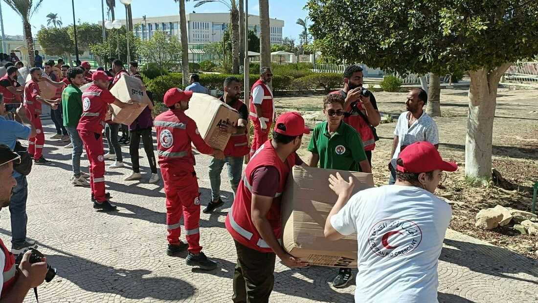
For aid workers and military personnel operating in the highly polarized Israeli-Palestinian conflict zone, the use of satellite technology is of great importance. Humanitarian organizations use satellite technology to monitor volatile and military action in Gaza and the West Bank. Data generated from satellite monitoring systems enable aid workers to coordinate the delivery of emergency services and basic needs to those affected by the conflict.
Despite the extended use of satellite communication and technology in war-torn areas, its importance is only becoming more apparent in the face of the Israeli-Palestinian conflict. The recent developments between Israel and Palestine have escalated their long-standing dispute to unprecedented levels, leaving millions of people in Gaza without access to water and other basic amenities. To add salt to injury, Israeli forces cut off all forms of communication in the conflict zone. They blocked the flow of humanitarian aid and supplies to the victims of the ongoing crisis.
This opened a global debate on using satellite communication to reconnect Palestine to the rest of the world and attracted satellite tech giant Starlink into the conversation. While Starlink’s billionaire owner, Elon Musk, expressed his wish to set up its terminals in Gaza, the dynamics on the ground require time and preparation before launch. As the world piles pressure on Israel to implement a ceasefire, humanitarian organizations continue to press for the delivery of food, medicine, and other basic amenities to the people of Palestine.
Satellite technology has become an indispensable tool for humanitarian organizations operating in conflict and war-torn areas. As the ultimate source of real-time data in such situations, satellite technology facilitates reliable communication. It enhances safety, all of which are essential for the effective delivery of humanitarian aid and making a positive impact in challenging and volatile environments.